URBAN PLANNING!
This studio has been our first shot at urban planning. Throughout this semester, we are progressing through various steps to create a new design for a large but unsusccessful central Barcelona plaza called Placa de les Glories. Placa de les Glories ("Glories") is a large public square that occurs at the intersection of the three most important traffic ways of the city: Gran Via, Diagonal, and Meridiana. Athough it has existed from the time of Cerda's original planning of Exiample in 1859, Glories has never integrated itself well within the city as a major public center, as was intended. Since its creation, there have been continued efforts to recreate Glories so that it satisfies its original objective, but so far none have been successful.

Left, an aerial image of Glories Plaza. The streets:
Runnng upper left to lower right is Diagonal
Running upper right to lower left is Meridiana
Running horizontally left to right is Gran Via
Why is Glories unsuccessful?
Placa de les Glories does not work well as an urban center for a variety of reasons. Primarily:
Various pieces of the plaza lack cohesion. A two level segregation of circulation occurs where the three roads meet, which disrupts circulation flows from minor surrounding Eixample streets. Circulation is further impeded where areas within the plaza are divided for railway traffic. Inside circular center is an empty area intended as greenspace, but which fails to draw people, due to it surrounding mess of streetway, railway, and awkward street arrivals from the Cerda scheme. Further exacerbating the problems that insufficient circulation imposes, a disparity of scales, created by the Agbar Tower by Jean Nouvel fragments the area and makes reading the urban fabric compicated.
Where is Glories?
Glories is at an intersection with the Eixample and the industrial sector if the city towards the south, near the shore. Diagonal is connector between the moutnains to the north, and the industrial ports and budding district of Sant Marti/ Poble Nou to the south. In addition, Glories occurs within a green diagonal along Meridiana that passes through the TGV railway station to the northeast.
What about Glories is worth the transformation?
Why are we trying to save Placa de les Glories? Glories has a lot of potential to be a major central space for Barcelona: 1. Its vertices are important; its location above the area of Poble Nou, its proximity to TGV station, and its location along Diagonal (connector between the moutains and the industrial seaports) make it a point of possbility. 2. Its location along a current green corridor makes it a possible location for a green node. 3. Glories location along the 3 major traffic veins makes it a possible intercommunicaion node.
First Things First
Eventually, everyone in our studio will individually design one building within a freshly (and successfully) designed Glories Square. Before that, we are taking on the task of replanning the square in order to make it compatible with the exisiting urban fabric.
How do we even take on the task of redesigning a plaza?
In order to understand how a plaza may be successful, we first studied existing plazas within Barcelona. For our first project, in groups of two we picked three major Barcelona plazas and created concept boards that described how each plaza evoked feelings within the visitor. Understanding the quality of a plaza helped us identify what urban aspects may be successful or unsuccessful.
The theme for my group's three concept boards was duality. For each plaza that we studied, we noticed that there existed at least two contrasting situations that depended on the surrounding area and the addition of architectural elements.

Left, Placa Juame Concept Board.
Placa Juame is a governmental center, intermingled with shops and cafes. Many visitors gather in this area. Why are some parts more densely packed than others? My partner in this project, Sean Owens, and I noticed that people tended to stay away from the areas flanked by governmental buildings, because of intimidating guards that stood watch by them.
Duality: comfort vs. discomfort as it affects pedestrian gathering
The governmental offices are colored red, the commercial ones are colored blue.

Left, Placa Reial concept board.
In Placa Reial, there are two distinct feelings of comfort and discomfort. One is comfortable in the open area near the fountain, and one is uncomfortable in the arched arcade, where shady people hang out....

Rambla de Raval is a long plaza in old town Barcelona that was created when a few blocks were torn down in an area near Sant Antoni Boulevard. In an effort to improve a diminishing area and allow greater views and open space into what were previously dark, narrow corridors, Rambla de Raval became a new place for locals to gather and use as a segway between parts of old town Barcelona.
In Rambla de Raval, there is a duality between calm and busy pedestrians. Along the middle of the rambla, many people pass through quickly as they head to other parts of old town. Palm trees line the outskirts, along each side of the rambla, and locals gather in these areas. Our board shows this duality using a meaphor of a highway flanked on either side by a calm beach.
Why?
Like I've mentioned before, we analyzed and created concept boards in order to understand how site and placed architectural elements affect the aura of a plaza, and in turn, one's experience.
Getting to Work: Placa de les Glories Massing
The first step in our design transformation of Glories was to redesign the city blocks within the plaza. Only designing basic forms and organization of builidngs is called massing. Designing massing first is necessary in order to get a general i dea of what will occur in a space before details, sucha as facades and pedestrian pass throughs, etc. can be designed.
We worked in groups of three this time, and after analyzing existing conditions that demonstrate problems with the current Glories (circulation difficulties, fragmentation of spaces), we developed a goal for the reorganization.
Left, some of my group's analysis of the major traffic veins that pass through Glories. To the left is a larger scale view, and the images on the right are at a smaller scale.
After our analysis, my group came ot the conclusion that we could characterize the current state of Glories as "segregated" and that our goal is to create integration on this site. A couple weeks before we really started to focus on the massing transformation, Eric Jenkins, a professor back at CUA, came to visit and we had a discussion about some literature he had given us to read and learn about urban design. From our discussion and the readings, it became apparent that some of the most successful urban design results from integration of uses within a city; when residential, commercial, and governmetal environments are mixed, the best results come forth. For example, in some of Barcelona's best plazas, comercial spaces occupy the lower floors or apartment buildings. From this, my group decided that it would be best to integrate uses in our design. We did this by:
1. Mingling built spaces into what the city had anticipated as a very large open area. By partially building in the central area of Glories, open and built space would combine.
2. Mingling green space along the green passage that occurs along Meridiana, and surrounding the central space
3. We decided to prioritize Diagonal in order to facilitate pedestrain movement and emphasize the passage from the mountains to the sea
4. We created a heirarchy of building heights (an initial increase from the exisiting Cerda blocks, then a gradual decrease towards the center of the plaza) to inform the visitor about the site and to relate to the large scale of Jean Nouvel's Agbar Tower.
First, we created a small scale site model, we open areas cut out for where we will design.
My group made this model out of wood.
Left, notes and ideas about massing and what would be appropriate for our design.
Below, a board on the left showing Glories' existing conditions, and a board to the right with our plans for massing shaded in black.
Left, a larger scale site model. Our massing model in the ligher chipboard in the center.
Left, a closeup of our massing model placed on the site. You can see how Diagonal (running top left to bottom right) is prioritized, with nothing interrupting its path.
We are about to move on the the block scale; that is, we will focus individually on designing the buildings for one block of our redesigned Placa de les Glories. After our field trip to Rome, we will work on the architectural scale and individually design floor plans and facade details for only one building.
 A typical sight in Southern Spain: orange trees!! There are some groves in Barcelona, but not as many as in Andalucia. We found out the hard way that the oranges were really sour.
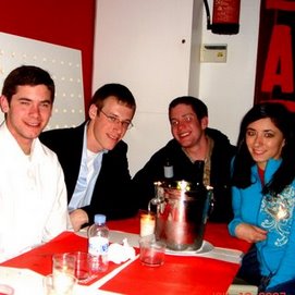
  Sean, Brian, Felipe, and Monica looking suave in Madrid.


